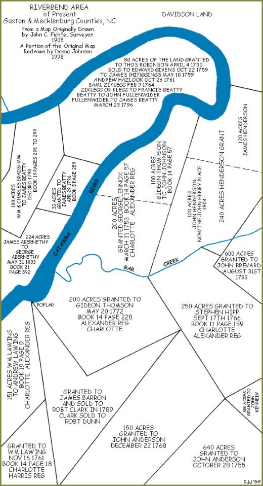
Note: This map is based on an original map drawn in 1905 by John Connelley Fichte, Surveyor, before Mountain Island Dam was erected on the Catawba River near Mount Holly. The water level rose significantly after the dam was constructed, covering much of the property that is shown.
The area that is shown is north and west of present-day Mount Holly-Huntersville Road and Beattie's Ford Road in Mecklenburg County, and southwest of Hopewell Presbyterian Church.